01
At a glance
Sub-project code
SP-06 · UAV-DRONE, one of seven sub-projects on the Southern University Mobile CAVE
Truck domain
Drone exploration
Aligned program
Reality Capture, Photogrammetry and BVLOS Simulation
BVLOS means flying beyond visual line of sight
the pilot cannot see the drone with their own eyes and relies on its sensors and data
First audience on the tour
utilities, ports and logistics, starting with an inspection demo
Campus base
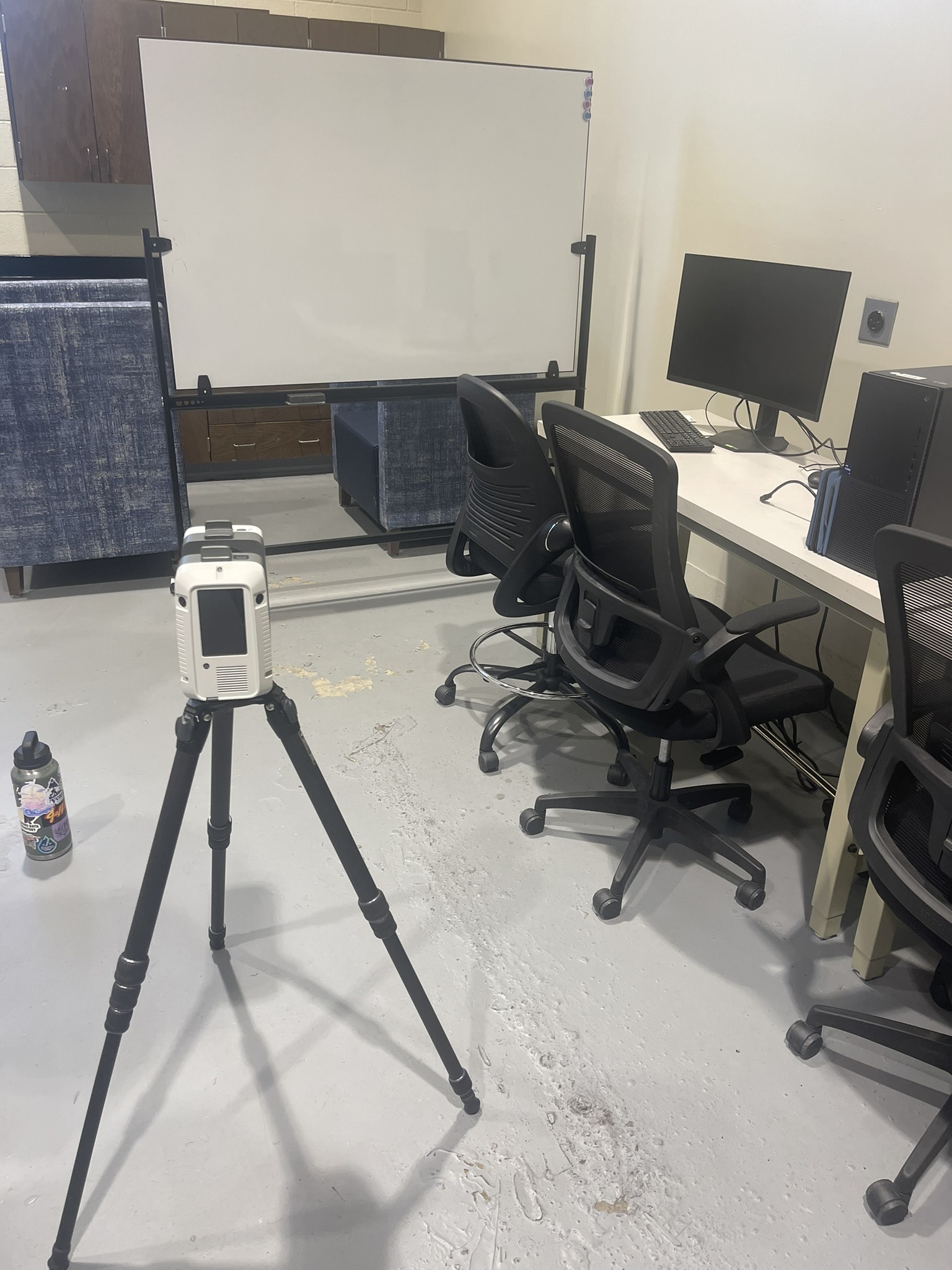
the XR Development Studio, which lists reality capture among its services and keeps a 3D scanner and build workstation in the studio
Youth reach
the university's Immersive Technology Center runs K-12 summer activities with VR, AI, drones and manufacturing
National context
the FAA had 481,760 certificated remote pilots and 837,513 registered drones as of November 2025
02
What it is
SP-06 is the drone domain of the Southern University Mobile CAVE. It prepares people to plan, fly and use the data from drone missions, starting with the hardest kind: inspections of places that are dangerous, hard to reach or out of sight.
The aligned program has three parts. Reality capture means turning a real place into an accurate digital model, using scanners and cameras. Photogrammetry is the method that makes that work from photos: in plain terms, measuring with images. Software processes many overlapping photos into maps and 3D point clouds. BVLOS simulation means practicing flights where the drone goes past what the pilot can see, which is exactly the kind of flight that long inspections of pipelines, power lines and ports require.
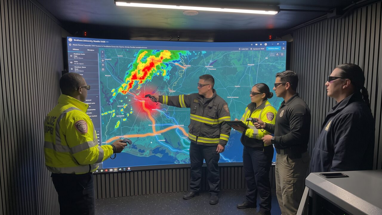
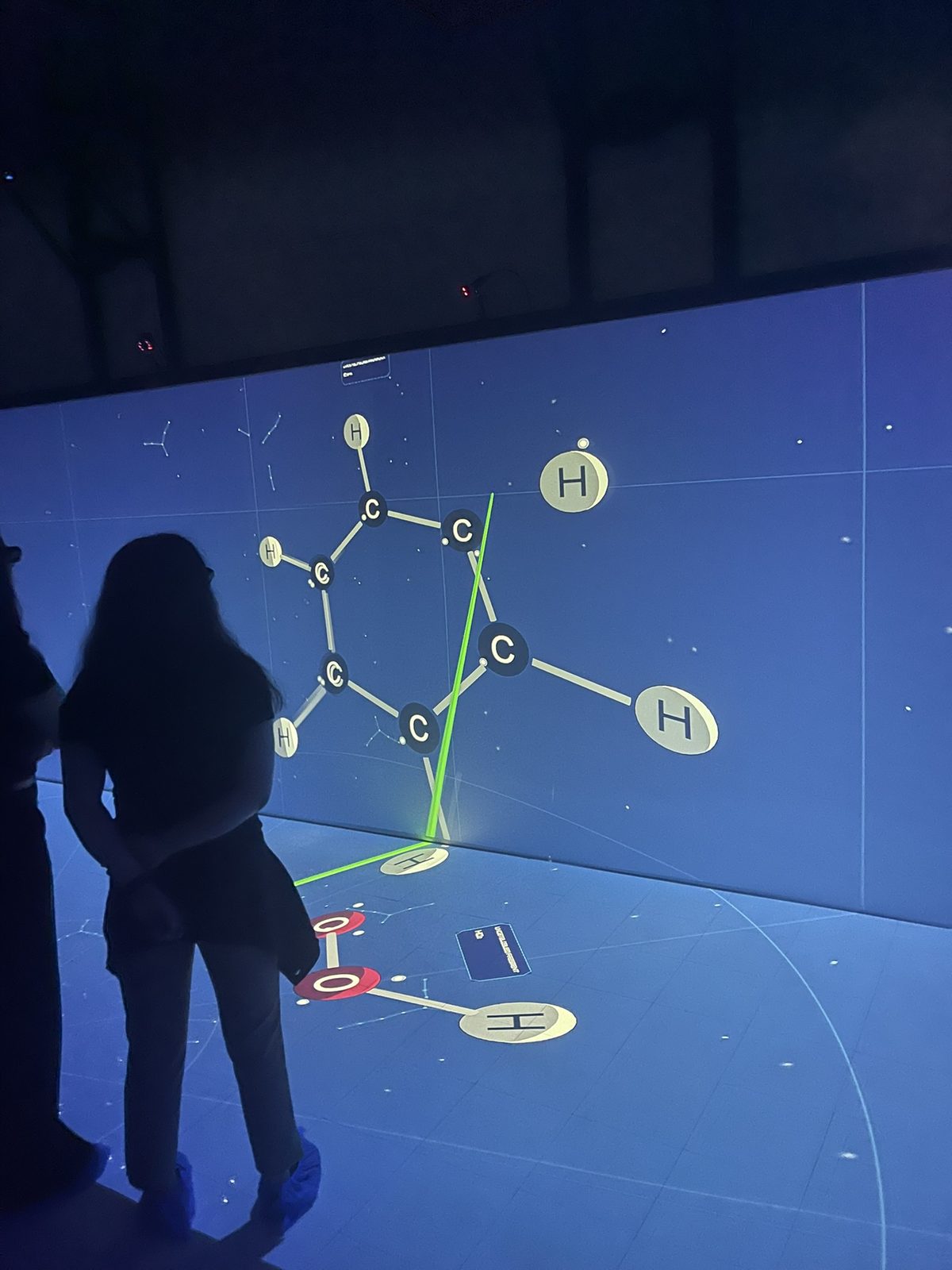
The Mobile CAVE is a natural place to teach this. A drone mission is spatial: the pilot has to understand where the aircraft is, what it can see and what is around it. Inside the CAVE, a group stands in a room-sized 3D model of a site, walks the inspection route together and sees the captured data at real scale.
The goal is simple to say. A new hire walks a drone inspection in 3D, makes mistakes that cost nothing, and repeats it until the steps are automatic, before ever putting a real aircraft near a real tank, tower or bridge.
03
How it works
Reality capture starts with data. A 3D scanner on a tripod, like the one in Southern University's XR Development Studio, or a drone camera flying a planned grid, records the site. Photogrammetry software turns overlapping photos into 2D maps and 3D point clouds.
The XR Development Studio builds VR content with Unity and OpenXR, the same tools behind the AM Lab printer modules. Captured data becomes a model of a real site that a learner can walk through.
The group stands inside the model in the Mobile CAVE wearing 3D glasses. They trace the route, mark the points to inspect, find obstacles and talk through what happens if the signal drops or the weather turns.
BVLOS simulation puts the pilot in the situation that matters most: the aircraft is out of sight and every decision depends on the data. The simulation lets the crew rehearse that, including the failures, with no aircraft at risk.
After the flight, the crew studies the images and models together at full scale. They practice what inspectors actually do with drone data: spot the problem, measure it and decide what needs a closer look.
The truck parks at a utility, port or logistics site for an inspection demo. Real flights follow the operator's own procedures and FAA rules.
04
Impact
Safer inspections
Drones reach places that put people at risk. A 2018 study for Louisiana by researchers at LSU and the University of Louisiana at Lafayette, through the Transportation Consortium of South-Central States, found that drones can reach bridge areas that are hard for human inspectors to access. The same study is clear that a drone is an assistance tool, not a replacement for inspectors. SP-06 trains people to use it that way: the drone gets the data, the trained person makes the call.
Jobs in a field that is growing fast
The FAA reported 481,760 certificated remote pilots as of November 2025. Drone work now shows up in surveying, agriculture, construction, telecom inspection and public safety. Photogrammetry companies report real time savings: one cites telecom tower inspections cut from 24 hours to one hour by building digital models from drone flights instead of manual climbs.
Louisiana's infrastructure
Louisiana's economy runs on plants, pipelines, ports, bridges and coastline. Industrial growth across New Orleans, Baton Rouge and Lake Charles, with $154 billion in projects in the pipeline according to a December 2023 BIC Magazine article citing economist Dr. Loren Scott, raises the demand for people who can inspect and document that infrastructure safely.
A first step for young people
The university's Immersive Technology Center runs K-12 summer activities with VR, AI, drones and manufacturing. SP-06 connects that early interest to a real career path, and the Mobile CAVE brings it to schools that do not have their own equipment.
The rules for drones are changing in a way that raises the value of BVLOS training. On August 7, 2025, the FAA published a notice of rulemaking for a new Part 108, a performance-based framework built to make BVLOS operations routine instead of relying on case-by-case waivers. The law firm DLA Piper describes it as the most significant commercial drone rule change since Part 107 in 2016. It covers uses such as package delivery, infrastructure inspection, precision agriculture and public safety, and it adds requirements such as safety management systems and certificated personnel. The 60-day comment period closed on October 6, 2025, with more than 3,000 comments.
That shift moves drone work from short, visible flights to long missions over pipelines, power lines, farms and coastline. Those missions need crews who can plan routes, manage risk and read data from aircraft they cannot see. Simulation is how they build that skill safely.
Reality capture is moving the same way. Photogrammetry turns photos into digital twins of towers, plants and construction sites, which teams use to track progress, compare as-built work against plans and measure volumes. The Mobile CAVE adds what a laptop screen cannot: a team standing inside that digital twin together, at full scale.
The 2018 Louisiana bridge study also points to the limits training must cover. It found that a drone can lose GPS navigation beneath a bridge deck and cannot detect subsurface concrete cracks or hollow timber, and that FAA rules and permissions can erase efficiency gains if missions are not planned well. Good training teaches those limits as clearly as the capabilities.
05
Why Southern University
Southern University already has the pieces. Its XR Development Studio builds VR apps for teaching, research and workforce training, lists reality capture among its services and keeps a 3D scanner and build workstation on site. Its Immersive Technology Center already introduces K-12 students to drones in summer programs.
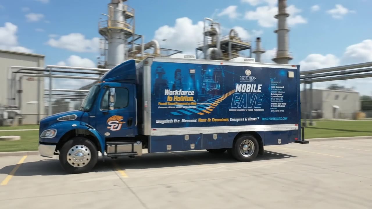
The Mobile CAVE gives that work a way to travel. The university describes the truck as conceived and led by students from concept to completion, and drone exploration is one of the eight training fields the truck lists: K-12, crisis, emergency, healthcare, technology, research, manufacturing and drones.
The university also has the research base to study what works. Southern's NSF-supported research on learning in a CAVE, published at the 2024 ASEE Annual Conference, built and validated ways to measure computational thinking among HBCU engineering students. The same step-by-step skills, breaking a mission into parts, spotting patterns and planning in order, are what a drone crew uses on every flight.
As an HBCU, Southern opens this field to students and communities who are underrepresented in aviation and geospatial work. HBCUs are about 3% of U.S. colleges yet awarded 28% of the STEM bachelor's degrees earned by Black students, according to UNCF's 2026 report.
06
Who it serves
Utilities, pipelines and energy
Crews rehearse inspections and emergency response that are costly to stage and hard to practice. The first tour session is an inspection demo.
Ports and logistics
Teams plan drone surveys of yards, docks and structures in a 3D model before flying them.
Public agencies and emergency teams
Drone data supports situational awareness after storms and disasters. SP-06 links to the crisis and emergency training of SP-02.
Students and K-12 learners
Southern University students get hands-on reality capture and simulation experience. Younger learners get their first look at drone careers when the truck visits their school.
Researchers
Faculty can study how people learn spatial and mission-planning skills in a shared 3D room.
07
Why fund it now
The rules are opening up. With BVLOS rulemaking under way, operators will need crews ready for longer, more complex missions. Training built now is ready when those operations become routine.
The risk is real and the practice is scarce. Real inspection flights near tanks, towers and bridges carry real hazards and real costs. Simulation lets crews practice the hard cases, including failures, as often as they need to.
The base exists. The studio, the scanner, the VR build tools, the K-12 drone programs and the truck are already in place. Funding connects them into a training domain that travels.
Funding makes specific things happen: site models built from real reality-capture data for partner facilities, BVLOS mission scenarios built with industry and public-safety partners, inspection demos at utilities and ports, and research that tracks what learners gain.
08
How it connects
SP-06 builds its content in the XR Development Studio and runs it on the Mobile CAVE kept on the road by Student-led Mobile CAVE systems integration (SP-07). It supports Crisis management and emergency preparedness (SP-02), where drone data helps teams understand a disaster scene, and Exploratory research and advanced visualization (SP-04), where captured models become research data. It shares plants and industrial partners with Manufacturing technologies and cyber-additive XR (SP-05). The Vision places it within one statewide training system.
09
Questions funders ask
No. The truck is where crews plan, rehearse and review in 3D. Real flights happen outdoors under the operator's procedures and FAA rules.
Beyond visual line of sight: the pilot cannot see the drone and relies on its data. It is what long inspections need, and the FAA's Part 108 rulemaking is built around making those flights routine.
Turning a real place into an accurate digital model with scanners and cameras. Photogrammetry, measuring with images, is one of the main methods.
Utilities, ports and logistics, starting with an inspection demo.
No. Louisiana research on drone bridge inspection describes the drone as an assistance tool. SP-06 trains people to use it that way.
Through the Immersive Technology Center's K-12 summer activities, which include drones, and through school stops on the Mobile CAVE tour.
10
Sources
- FAA Drones by the Numbers
- FAA Part 108 BVLOS rulemaking (DLA Piper, October 13, 2025)
- Bridge Inspecting With Unmanned Aerial Vehicles, R&D (Tran-SET, LSU, 2018)
- Five industries that use photogrammetry (Pix4D)
- Skilled workers needed for Louisiana's industrial construction boom (BIC Magazine, December 13, 2023)
- Immersive Engineering Learning and Workforce Development: Pushing the Boundaries of Knowledge Acquisition in a CAVE (ASEE 2024)
- HBCUs make up just 3% of U.S. colleges but produce 28% of Black STEM graduates (TheGrio, on UNCF's report)